चित्र:Chennai Kathipara bridge.jpg

या झलकेचा आकार: २२० × १४६ पिक्सेल पिक्सेल. इतर resolutions: ३२० × २१३ पिक्सेल | ९२७ × ६१७ पिक्सेल.
मूळ संचिका (९२७ × ६१७ पिक्सेल, संचिकेचा आकार: ३५७ कि.बा., MIME प्रकार: image/jpeg)

सारांश
| वर्णनChennai Kathipara bridge.jpg |
English: Kathipara Junction is an important road junction in Chennai, India. It is located at Alandur, (St.Thomas Mount), south of Guindy, at the intersection of the Grand Southern Trunk Road (NH 45), Inner Ring Road, Anna Salai and the Poonamallee Road. Releasing the image under: Attribution-NonCommercial Creative Commons |
| दिनांक | |
| स्रोत | Link to Photograph's Original Flickr Page |
| लेखक | Pratik Gupte |
परवाना:
 
|
This file is licensed under Creative Commons ShareAlike 1.0 License.
Creative Commons has retired this legal tool and does not recommend that it be applied to works.
|
| Creative Commons ShareAlike 1.0 GenericCC SA 1.0http://creativecommons.org/licenses/sa/1.0/falsetrue |
Captions
Add a one-line explanation of what this file represents
संचिकेचा इतिहास
संचिकेची त्यावेळची आवृत्ती बघण्यासाठी त्या दिनांक/वेळेवर टिचकी द्या.
| दिनांक/वेळ | नखुले | आकार | सदस्य | प्रतिक्रीया | |
|---|---|---|---|---|---|
| सद्य | १४:४७, २० सप्टेंबर २०१२ | 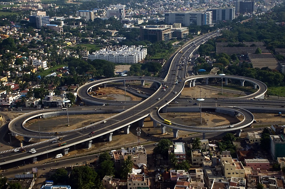 | ९२७ × ६१७ (३५७ कि.बा.) | smartcommons>Anbu121 | Original Color Restored |
संचिका वापर
या चित्राशी जोडलेली पृष्ठे नाहीत.
