चित्र:Kashmir map.svg

मूळ संचिका (SVG संचिका, साधारणपणे २,१६० × १,६९६ pixels, संचिकेचा आकार: २२० कि.बा.)
सारांश
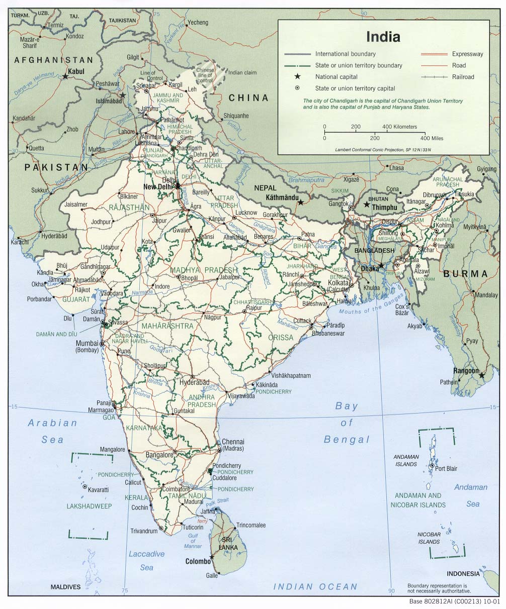
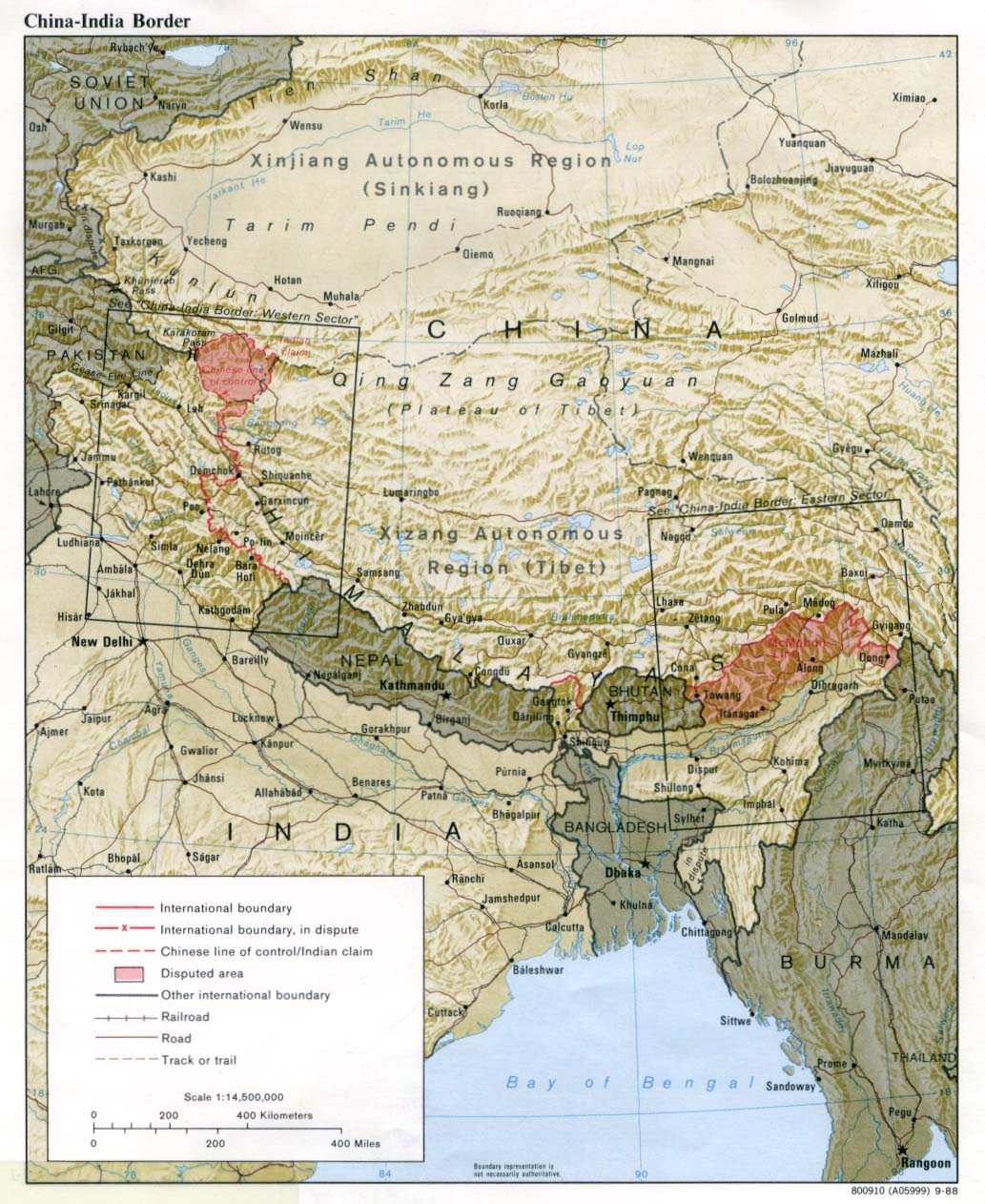
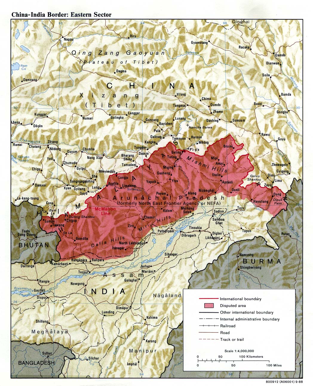
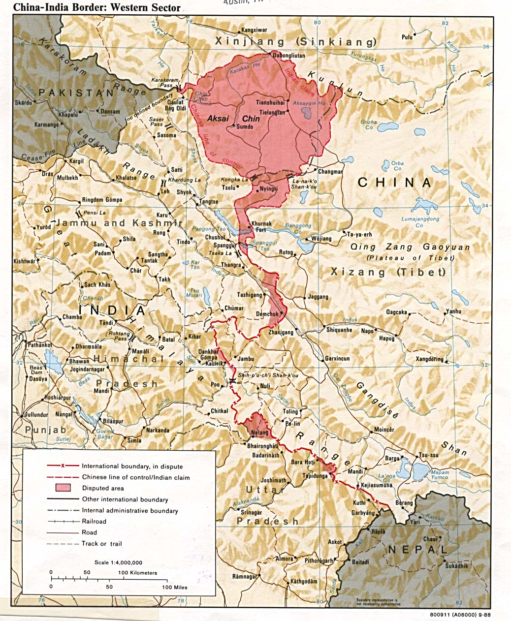
| वर्णनKashmir map.svg | Locator map for the state of w:Jammu and Kashmir. |
| दिनांक | |
| स्रोत |
स्वतःचे काम |
| लेखक | w:user:Planemad |
| परवानगी (या संचिकेचा पुनर्वापर करीत आहे) |
|
| इतर आवृत्तींस |
[]
Others
|
| SVG genesis InfoField |

.svg)


![[1]](http://www.mapsofindia.com/maps/jammuandkashmir/jammu-and-kashmir-map.jpg)

परवाना:


- तुम्ही मुक्त आहात.
- सामायिक करा – नक्कल, वितरण आणि पारेषित करण्यास
- पुर्नमिश्रीत करण्यास – काम गरजेनुसार अनुकुलीत करण्यास
- खालील अटींच्या अधिन राहून:
- रोपण – आपण योग्य क्रेडिट देणे आवश्यक आहे, परवान्यास दुवा प्रदान करणे आवश्यक आहे, आणि बदल केले गेले आहेत हे दर्शविणे आवश्यक आहे. आपण हे कोणत्याही वाजवी मार्गाने करू शकता, परंतु परवानाधारक आपल्यास किंवा आपल्या वापरास मान्यता देतो अशा कोणत्याही मार्गाने नाही.
- जसेहोते-वाटातसेच (शेअर अलाईक) – जर तुम्ही या कामात काही बदल केलात, काटछाट केलीत, किंवा भर घातली, तर असे करून बनलेले नवीन काम तुम्ही केवळ या किंवा यासारख्याच परवान्याअंतर्गत प्रसारित करू शकतात.
Captions
संचिकेचा इतिहास
संचिकेची त्यावेळची आवृत्ती बघण्यासाठी त्या दिनांक/वेळेवर टिचकी द्या.
| दिनांक/वेळ | नखुले | आकार | सदस्य | प्रतिक्रीया | |
|---|---|---|---|---|---|
| सद्य | १३:०२, २३ मे २०२५ | 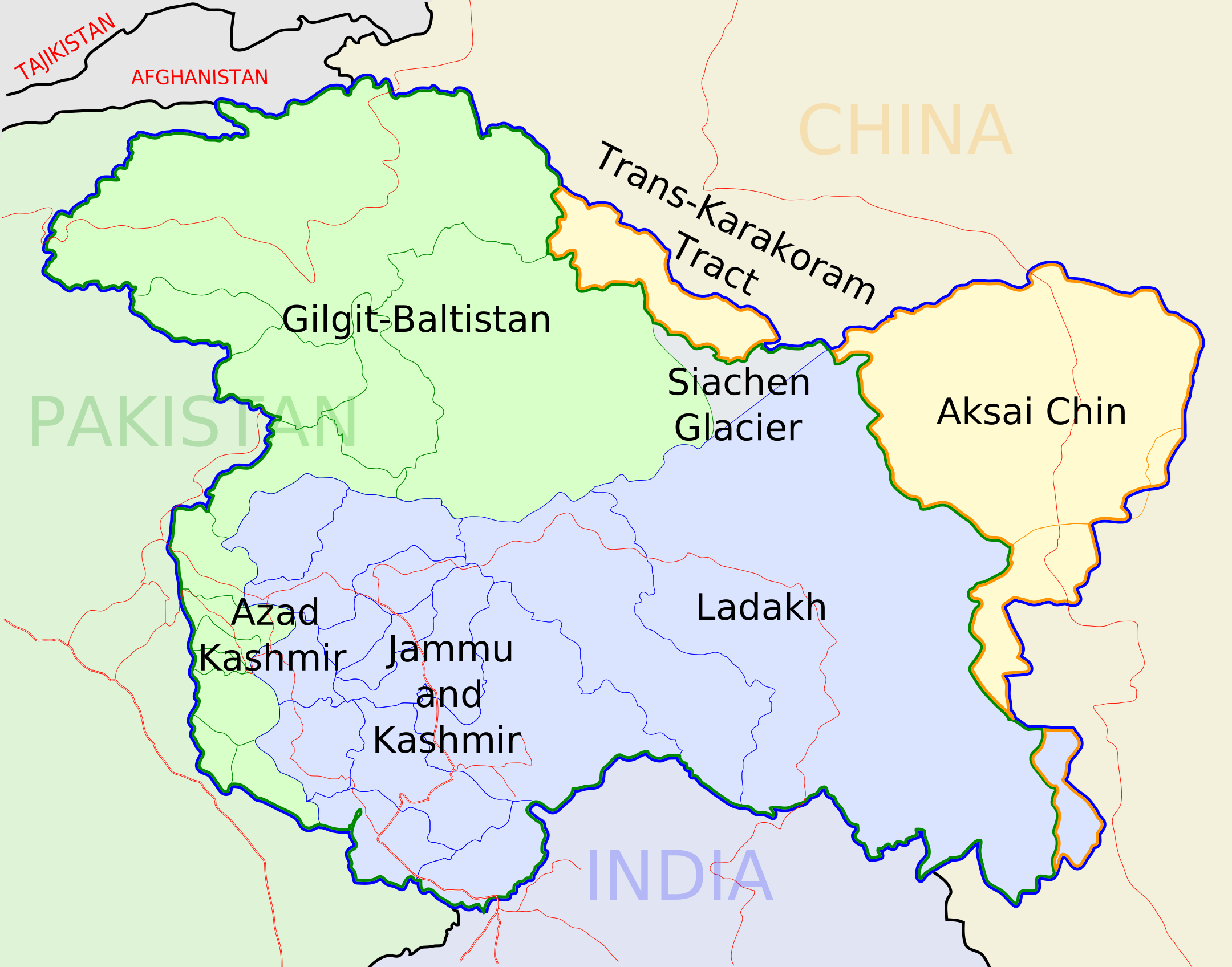 | २,१६० × १,६९६ (२२० कि.बा.) | smartcommons>Turisindo | File uploaded using svgtranslate tool (https://svgtranslate.toolforge.org/). Added translation for it. |
संचिका वापर
या चित्राशी जोडलेली पृष्ठे नाहीत.
