चित्र:Nagorno-Karabakh conflict map (pre-2020).png
.png)
या झलकेचा आकार: २२० × ११० पिक्सेल पिक्सेल. इतर resolutions: ३२० × १६० पिक्सेल | १,००० × ५०० पिक्सेल.
मूळ संचिका (१,००० × ५०० पिक्सेल, संचिकेचा आकार: १३० कि.बा., MIME प्रकार: image/png)
.png)

|
This map image could be re-created using vector graphics as a SVG file. This has several advantages; see Commons:Media for cleanup for more information. If a SVG form of this image is available, please upload it and afterwards replace this template with
{{vector version available|new image name}}.It is recommended to name the SVG file “Nagorno-Karabakh conflict map (pre-2020).svg”—then the template Vector version available (or Vva) does not need the new image name parameter. |
सारांश
| वर्णनNagorno-Karabakh conflict map (pre-2020).png |
English: This map describes the situation in the disputed Nagorno-Karabakh region prior to the 2020 war. The region is internationally recognized as part of Azerbaijan but partly governed by the de facto independent Republic of Artsakh. The image is a modified version of MarshallBagramyan's map. |
| दिनांक | |
| स्रोत | File:Artsakh Occupation Map.png |
| लेखक | Elnur Hajiyev |
परवाना:
| Public domainPublic domainfalsefalse |

|
This work has been released into the public domain by its author, Elnurvl. This applies worldwide. असे करणे काही देशांमधे कायद्यानुसार शक्य नसू शकते. असे असल्यास : |
Captions
Add a one-line explanation of what this file represents
Map of the Nagorno-Karabakh conflict prior to 2020
संचिकेचा इतिहास
संचिकेची त्यावेळची आवृत्ती बघण्यासाठी त्या दिनांक/वेळेवर टिचकी द्या.
| दिनांक/वेळ | नखुले | आकार | सदस्य | प्रतिक्रीया | |
|---|---|---|---|---|---|
| सद्य | ०६:४८, ७ ऑगस्ट २०२० | 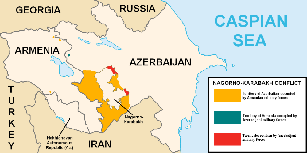 | १,००० × ५०० (१३० कि.बा.) | smartcommons>Elnurvl | Uploaded a work by Marshall Bagramyan from https://en.wikipedia.org/wiki/File:Artsakh_Occupation_Map.png with UploadWizard |
संचिका वापर
या चित्राशी जोडलेली पृष्ठे नाहीत.
.png)