चित्र:Spice Islands (Zanzibar highlighted).svg
नखुले निर्माणात त्रुटी: संचिका अस्तित्वात नाही
मूळ संचिका (SVG संचिका, साधारणपणे ७१३ × ८७९ pixels, संचिकेचा आकार: ११ कि.बा.)
 Any autoconfirmed user can overwrite this file from the same source. Please ensure that overwrites comply with the guideline.
सारांश
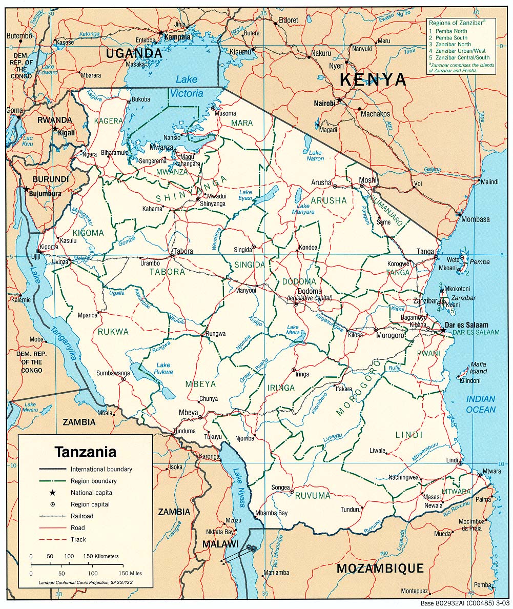
| वर्णनSpice Islands (Zanzibar highlighted).svg | Part of the map of Tanzania, showing the Spice Islands, and highlighting Zanzibar. |
| दिनांक | |
| स्रोत | Vectors self-made in Inkscape. Source was cropped from 2003 Political map of Tanzania at Perry-Castañeda Library Map Collection — Tanzania. The maps are attributed to the US Central Intelligence Agency. |
| लेखक | Mysid |
| इतर आवृत्तींस |
Derivative works of this file: Image:Spice Islands (Tanzania).svgin French : Image:Spice_Islands_Tanzania-fr.svg in French : Image:Spice_Islands-Zanzibar_highlighted-fr.svg in Arabic: Image:Spice Islands (Zanzibar highlighted)-ar.svg |
| SVG genesis InfoField |


.svg)
_el.svg)
_sv.svg)
.svg)


-ar.svg)

परवाना:
| Public domainPublic domainfalsefalse |

|
I, the copyright holder of this work, release this work into the public domain. This applies worldwide. असे करणे काही देशांमधे कायद्यानुसार शक्य नसू शकते. असे असल्यास : मी कोणालाही कोणत्याही कारणासाठी हे काम वापरण्याचे अधिकार कोणत्याही बंधनाशिवाय जर अशी बंधने कायद्याने बंधनकारक नसतीलतर देत आहोत. |
Captions
Add a one-line explanation of what this file represents
Map of Zanzibar
संचिकेचा इतिहास
संचिकेची त्यावेळची आवृत्ती बघण्यासाठी त्या दिनांक/वेळेवर टिचकी द्या.
| दिनांक/वेळ | नखुले | आकार | सदस्य | प्रतिक्रीया | |
|---|---|---|---|---|---|
| सद्य | २३:२७, २ नोव्हेंबर २०२४ | नखुले निर्माणात त्रुटी: संचिका अस्तित्वात नाही | ७१३ × ८७९ (११ कि.बा.) | smartcommons>Dchestnykh | Redo the previous version in vector |
संचिका वापर
या चित्राशी जोडलेली पृष्ठे नाहीत.
.svg)